On Saturday, July 09th, 2022 representatives from several agencies and persons from the community convened to participate in a field mapping training and exercise in Vieux-Fort from 9:30am-4:00pm.
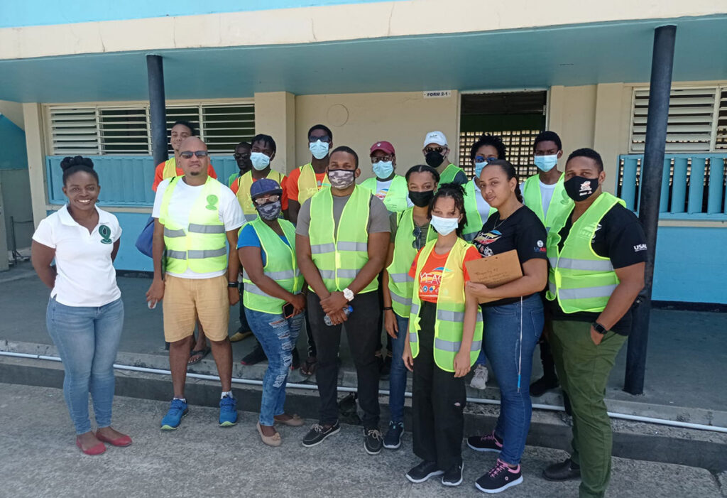
The exercise is being implemented under the Map4SaintLucia initiative. Participants included representatives from their partner agencies Red Cross, NEMO and the Youth Emergency Action Committee (YEAC); as well as volunteer mappers and individuals from the community.
During this exercise, participants were taught how to use a digital mapping platform to create maps of a community and then go into the field to validate the data collected. They are also taught to utilize a mobile-based tool for field-mapping. Such maps play an important role in building disaster resilience; as they serve as an important tool in providing critical information for disaster planning, response and assessments. They are often used prior to and in the aftermath of hurricanes, landslides, earthquakes and floods.
The exercise was facilitated by OpenStreetMap Specialist and adjunct Professor at George Washington University, Steven Johnson and Geographic Information Systems specialist, Christopher Williams.
Map4SaintLucia is funded via a unique global partnership between the Humanitarian OpenStreetMap team (HOT), SwissRE Foundation and the Global Facility for Disaster Reduction and Recovery (GFDRR) which focuses on the use of geospatial data for building resilience and reducing vulnerability to disasters. Learn more about Map4SaintLucia at https://linktr.ee/map4lc.
Map4SaintLucia expressed gratitude to their partners and also to: Vieux-Fort Comprehensive Secondary School, the Vieux-Fort South Constituency Council; LUCELEC and the Windward &
Leeward Brewery LTD for supporting the mappers who are working to build Saint Lucia’s digital map and by extension, a more resilient Saint Lucia.


![Attendees at the UHC logo and website launch [Photo credit: GOSL]](https://thevoiceslu.com/wp-content/uploads/2026/02/Attendees-at-the-UHC-logo-and-website-launch-380x250.jpg)



![Remnants of an alleged drug boat blown up in a lethal strike by the U.S. military last week surfaced off Canouan on Saturday [Photo credit : St Vincent Times]](https://thevoiceslu.com/wp-content/uploads/2026/02/Remnants-of-an-alleged-drug-boat-blown-up-380x250.jpg)

