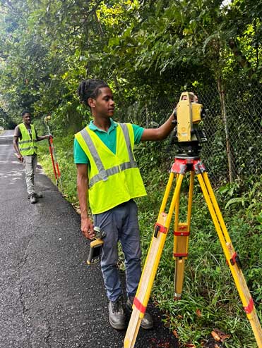
Under the Department of Infrastructure, Ports and Transport, The Renewable Energy Sector Development Project (RESDP), in conjunction with the Office of the Pitons Management Area, has engaged the services of Land Surveyors to survey the limits of the Pitons Management Area (PMA). The survey, which commenced on November 30, 2023, will continue for a nine-month period and will define the boundaries and coordinates of the Piton Management Area and the Green Buffer Zone.
The survey will include both the local coordinate system and the Global Positioning System (GPS) coordinates of the boundary lines and will be registered with the Survey and Mapping Section of the Department of Physical Development and Urban Renewal on completion.
The purpose of this project is to set up a green boundary, or a green buffer zone, for protecting the character of the PMA, a World Heritage Site, prior to commencing the geothermal exploration.
For Saint Lucia, The Pitons Management Area (The PMA) is an area of outstanding natural beauty in Soufriere, with spectacular geological features and is a highly sensitive biological resource area. In 2018, the World Heritage Committee urged Saint Lucia to formally establish a buffer zone for the UNESCO World Heritage Site (the PMA) and to clarify the type of activities permitted in this buffer zone and that once the activities are defined, the buffer zone should be formally recognized under the World Heritage Convention. We are pleased that this has commenced and look forward to its fruition.
Manager of the Piton Management Area, Mrs. Joan Hippolyte sees this survey as critical to preserving the world heritage designation, stating that “The guidelines for the implementation of the World Heritage Convention require that a buffer zone be established for the purpose of effective protection of the PMA. Details of the size and characteristics of the buffer zone as well as a map indicating the precise boundaries of the buffer zone are required under the Whole Heritage Convention. Steep and visible slopes near the PMA must be protected from development because of environmental impacts. The survey of the boundaries is therefore a step in the right direction.”
Through the PMA demarcation, the World Heritage status of the PMA will be guaranteed, and it will continue to attract both local and overseas visitors, thereby providing employment opportunities within the communities. Further, zoning would allow a balanced approach to development, by permitting and managing certain tourism related activities and geothermal exploration and development.
Communities are asked to take note that during the nine-month survey period, the surveyor and his crew will mark the PMA boundary with special pegs 150 metres (164 yards) apart along the road edge. Community members can seek clarification or raise any issue with the RESDP Community Liaison Officer.